Location Info
- Nearest Postcode: BH19 3AH
- GPS: 50.651853, -1.955800
- OS Grid Reference: SZ 032 836
- Show full map in: Google Map / Bing OS Map / OpenStreetMap
Event Details
- Date: –
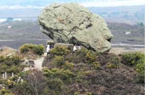
- Event area (map): Agglestone and Rempstone Forest
- Categories: Event, Organised by Wessex OC, Results
Results available:

Post Event Comments:
Caddihoe Chase 2016 – Agglestone & Rempstone | Wessex and Wimborne Orienteers
(Control 42 was excluded from the results calculations after a number of comments that it may have been misplaced. This affects the Black, Brown,Short Brown and Blue courses. See Planner’s comments below)
Day 1 – Control number 42
During the course of the competition on Day 1, I received a significant number of complaints about control number 42, which was visited by the Black, Brown, Short Brown and Blue courses.
All courses had the same preceding control, number 38. Both controls being used as a transition from the more technical ‘Gully’ area visited from the start down to the technical area on the heath.
In planning, I did every leg of every course, in order to make sure they worked and that the map allowed you to navigate to the feature.
For this particular leg, with the rough nature of the terrain at this point, I had assumed that all competitors would exit control 38 and maximise the use of the roughly West/East track to a point where they would drop due South over the rough open and into the shallow re-entrant. In doing this, I anticipated that competitors would see the copse of tall trees and keep to the East, dropping into the re-entrant. As far as I can tell from talking to a good number of competitors, for the majority of those who executed the leg without wasting much time, this is what they did.
I had not anticipated that competitors would approach the control from the West, coming into the copse of tall trees to then drop into the re-entrant. As a result, I did not check this part of the map to ensure that the map was accurate and that the route was possible.
Again from talking to competitors, it appears that a good number of people had attempted to do this and the majority of those who did so lost significant amounts of time as a result (estimates from those I spoke to varied between 3 and 10 minutes). Essentially the map was not at all accurate from this direction of approach. The copse was not well mapped; the extent of the tree cover was in error; the density of trees was not well mapped; and a large, very impenetrable wall of gorse was not mapped at all. All of these made it very difficult and somewhat confusing for competitors trying to take the control from this direction.
In addition, the position of the circle marking the control location was at the mid-point of the re-entrant. The tape, and hence the position of the flag, was in fact slightly lower down, closer to the Marsh.
Subsequent inspection of the site after the event confirmed the errors in the map and confirmed that the control was about 10 meters further down the re-entrant than it should have been. With the rough nature of the terrain at this point, 10 meters became significant.
Following the significant number of complaints about the control, discussions were held with the Controller and we both felt that the fairest approach was to exclude this leg from all four courses, as competitors approaching from the West had been significantly disadvantaged.
Informal discussions were also held with the designated jury, who, although they had no formal role as a formal complaint had not been lodged, confirmed the action that was available to us. The rules for events below Level A allowed for a decision to be made to exclude a leg(s) from a course. This decision had to be taken by the Organiser. The Organiser was consulted and between the three of us (Planner, Controller and Organiser), we felt this was the fairest action we could take.
I can only offer apologies to all competitors on these courses and learn the lesson that all possible approaches to a control should be checked, whether or not I would consider using them myself.
Dale Paget
Day 1 Planner
Pre-Event Bulletin: